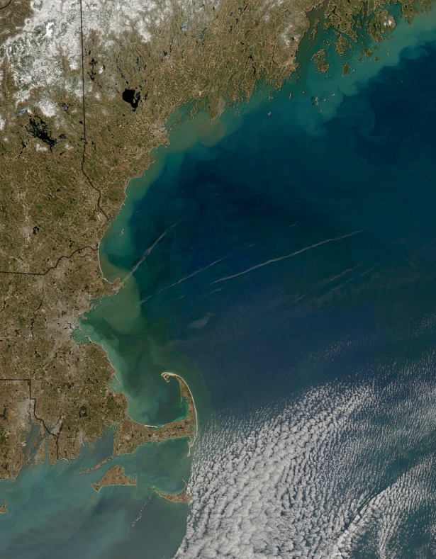
An area of emphasis and expertise within our lab is satellite ocean remote sensing. We are engaged in research projects involving spaceborne ocean color, salinity, sea surface temperature, sea level and wind & wave measurements. OPAL scientists belong to numerous NASA and international space agency science teams. Recent emphasis has been on air-sea interactions, multi- and hyperspectral visible imaging, and on new capabilities for coastal ocean remote sensing made possible using the passive microwave salinity measurements in combination with ocean color data.
Following is a partial list of projects that are currently ongoing within the lab:
"Amazon river discharge and its influence on tropical Atlantic SST and mixed layer dynamics", NASA Phys. Oceanography Program, 2013-2016, PI: D. Vandemark
"Langrangian studies during the NASA GEO-CAPE Gulf of Mexico field campaign",
NASA, 2013 - 2015, PI: J. Salisbury
"Development of Novel Detection and Prediction Algorithms for Mycrocystis Blooms", NIH, 2012-2015, PI: T. Moore
"Seasonal to Interannual Variability in Phytoplankton Biomass and
Diversity on the New England Shelf: In Situ Time Series for Validation
and Exploration of Remote Sensing Algorithms", NASA The Science of Terra
and Aqua, 2011-2014, PI: H.Sosik/WHOI, UNH lead: H. Feng
"Lagrangian Tracking of Satellite Products with a Numerical Model: A New Method for Diagnosing Net Community Production and Carbon Export in the Ocean", NASA Ocean Biology and Biogeochemistry Program, 2008-2013, PI: J. Salisbury
"Exploiting synergies between ocean wind-wave modeling and satellite altimetry", NASA Ocean Surface Topography Science Team, 2013-2016, PI: D. Vandemark
"Investigating the global distributions of coccolithophore blooms in relation to ecological niche concepts", NASA New Investigator Program, 2013-2015, PI: T. Moore
"Applying EOS-Aqua, altimetry and wave model data to improve Aquarius salinity measurements", NASA Ocean Surface Salinity Science Team, 2010-2013, PI: D. Vandemark
"Determining geophysical impacts on scatterometer wind stress accuracy", NASA Ocean Vector Wind Science Team, 2010-2014, PI: D. Vandemark
"Optical Water Type-Based Uncertainties of Satellite Ocean Color Products", NASA Data Record Uncertainty Analyses, 2011-2014, PI: T. Moore
"A climate data record of altimetric sea level change and its mass and steric components",NASA Measures project, 2013-2017, PI: J. Willis/JPL, UNH lead : D. Vandemark
"Tracking Dissolved Organic Carbon and its Absorption Characteristics along the Aquatic Continuum over Time using a Remote Sensing Based Approach", NASA, 2009 - 2014, PI: W. Wollheim/UNH
"Altimetric ocean wave products for NOAA NWS Ocean and Tropical Prediction Centers", NASA Accel. Operational Data Use program, 2008-2010, PI: V. Zlotnicki/JPL, UNH lead : D. Vandemark
"Aerosol variability and its impact on satellite ocean color in the Gulf of Maine and northern New England region", NASA NIP, 2008-2012, PI: H. Feng
"Use of the Martha's Vineyard Coastal Observatory (MVCO) to assess ocean
color products in North East coastal waters", NASA Ocean Biology and
Biogeochemistry, 2006-2008, Co-Is: J. Morrison, H.Feng, H.Sosik/WHOI, B.
Arnone/NRL.

